The Ancient Punic Harbor, Mahdia Tunisia

Thumbnail created with Canva
Hello steemians,
On 14 September 2025 I walked the wind-polished tip of Mahdia to document the Punic Harbor (cothon) and the lighthouse headland for Steem Atlas because the area is an open public shoreline, entry was free, so I focused on precise wayfinding, practical timing, safety notes, and an image-led route that anyone can follow without a guide while still understanding what they are looking at and how the pieces fit together.
Getting there, when to go and what to expect
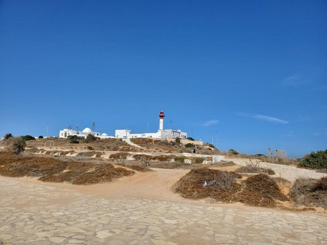
The site sits at the very end of the peninsula by the Phare de Mahdia in the Borj Erras district, and the approach is intuitive: you simply follow the seafront road (the corniche) until it can go no farther, at which point the white lighthouse appears as a fixed reference that keeps you oriented no matter which rock platform you explore. Taxis from the SNCFT station or the central medina know the lighthouse roundabout and will drop you within a few meters of the stone paths, while drivers can park along the curb and continue on foot. There are no gates or ticket booths, so you can come at any hour, yet the experience is most rewarding in the first two morning hours and the late afternoon “golden” window, when the glare eases, the stone cools, and the water shows its green-to-cobalt gradients that photographers and casual walkers alike will appreciate.
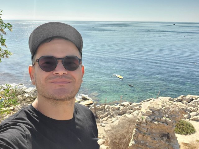
Starting above the rock shelves lets you see how platforms, ladders and calmer pools line up along the headland.
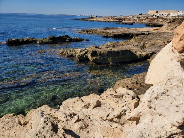
Reading the coastline: vestiges, platforms and working sea
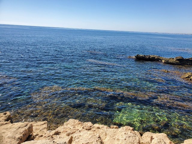
As you step down from the road, the ground turns from paving to cream-colored bedrock whose edges are too straight to be entirely natural; this is where the old harbor logic reveals itself in shallow recesses, squared cuts and level benches that likely served as working ledges and slips, now softened by weather yet still legible if you move slowly and look for right angles hiding in the surf.
 |  |
|---|
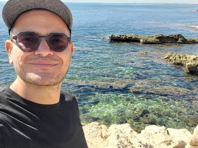
Transparent water exposes the chiselled floor plates and the meadows of posidonia weaving between human-made lines.
Walk fifty meters farther and the geometry strengthens: you come upon rectilinear pockets and long, straight edges that almost behave like the plan of a drained dockyard, and although centuries of reuse have blurred the exact blueprint, the stone still reads like a ledger of maritime work hauling, cleaning, loading compressed into one rugged terrace.
Right-angled cuts and level benches suggest how ships were serviced when the cothon was active.
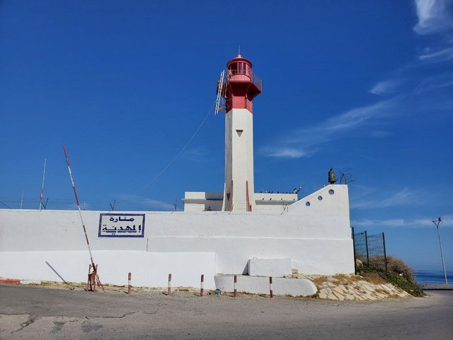
The lighthouse as both compass and composition
The lighthouse itself is not open to visits, yet its white walls and red lantern provide an unfailing compass and a clean backdrop for images; from almost anywhere on the rock you can bring the tower into frame to anchor the horizon, which makes it easier to keep your bearings while you roam the ledges.
 |  |
|---|
A working light, not a museum, respect the fences and shoot it from the road or the terraces.
Edges, swell and a solitary boulder locals nickname “the inverted stone”
On calmer days the outer rim is a gentle lip where swimmers slide into natural pools, but when the swell is up the same edge breathes spray and white water, so give yourself margin and protect your electronics, a few meters offshore a rounded boulder stands like a misplaced sculpture, catching the chop and throwing a neat shadow on clear water at noon.
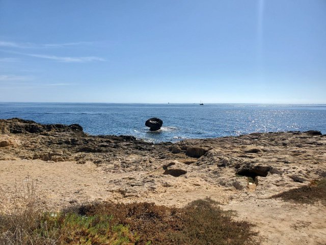
A single rounded block punctuates the horizon and reveals how the waves refract around the headland.
Benches, breathers and wide-open horizon on the corniche terrace
Where the road widens you find a small terrace with benches and a long parapet, it is the easiest place to reset sip water, check maps, swap to a wider lens without losing the view, since the entire background is nothing but sky and sea.
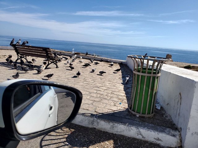
Everyday civic furniture against an endless blue stage good for a pause between photo stops.
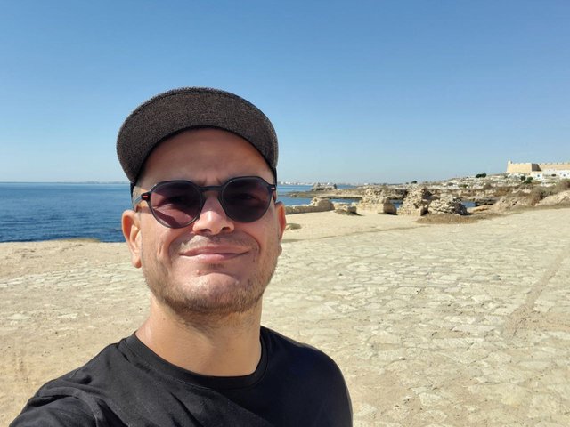
Low entries to the rock shelves and families at the water
Back near the start, shallow inclines lead down to flat platforms where locals spread towels and anglers set lines, on windless mornings these ledges double as low entries to the water, while at sunset they become front-row seats for the glitter path that runs straight out to the fishing boats.
Informal “rooms” carved by sea and time, bring water shoes if you plan to swim from the stone.
A freestanding sea gate that frames the light
One of the headland’s most photogenic moments is a freestanding arch, often dubbed Beb Bhar that behaves like a ready-made frame for the horizon, step slightly off-center and let the curve of the opening lead the eye toward the shimmer so your portrait includes both sculpture and sea without harsh shadow bands.
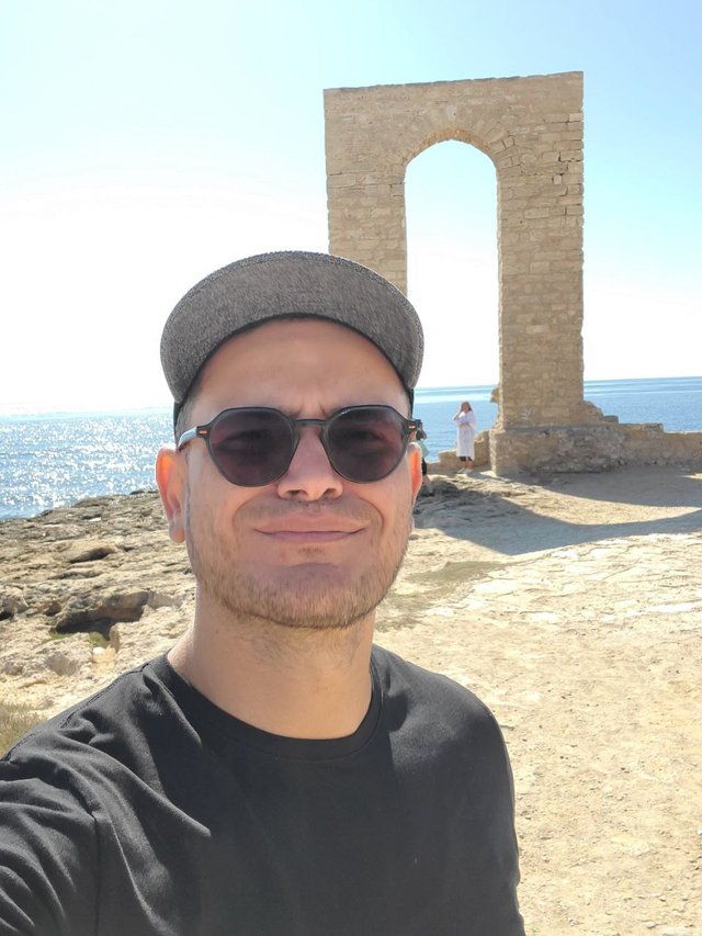
The stone’s warm tone plays beautifully with late-afternoon light—vertical framing works best here.
End on a panorama and let the scene explain itself
Before you loop back, stop at an elevated shoulder and take in the entire panorama, only then do the pieces snap together,the old cuts in the rock, the working lighthouse, the family platforms and the boats on the same glittering plane proving that Mahdia’s tip is not an exhibit behind glass but a living coastline where history, navigation and leisure coexist day by day.
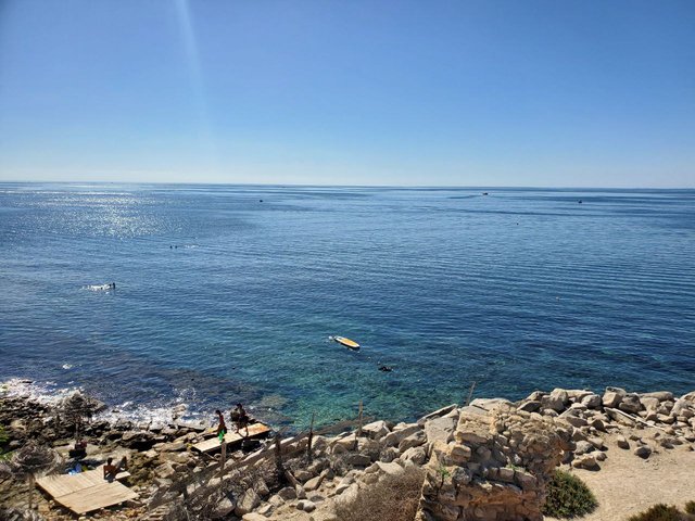
Boats, swimmers and stone platforms share one luminous field when the sea is calm.
Safety, comfort and low-budget planning
Because surfaces are irregular and sometimes wet, non-slip sandals or water shoes prevent stubbed toes and make sea entries easy, carry drinking water, a hat and reef-safe sunscreen since there is almost no shade, and keep a respectful distance from blowholes and fenced corners of the lighthouse compound. The whole excursion can be done with zero entrance cost, and if you arrive on foot from the medina you can experience a gentle build-up from cafés and tackle shops to rock and wide water without ever worrying about parking.
Practical Information
| Item | Details |
|---|---|
| Opening Hours | Every day, 24 hours |
| Address | G34H+6JX, Mahdia |
| Google Maps | https://maps.app.goo.gl/yxftSasc1Nabryzv6 |
| Steem Atlas | //:# (!steematlas 35.50604604 lat 11.07920751 long d3scr) |
| Best Time to Visit | Sunrise and late afternoon (08:30–10:00 & 16:30–18:30) for softer light, cooler stone and calmer water. |
| Useful Services | Curbs for parking, benches along the corniche, informal swimming platforms, nearby cafés/kiosks for drinks, bring your own water and first-aid basics. |
Best Regards,
@kouba01

Upvoted! Thank you for supporting witness @jswit.
Hello @kouba01
Thank you for using Steem Atlas and pinning your post.
Here is the detailed information.
Your post has been displayed on the Steem Atlas map.
https://steematlas.com/@kouba01/the-ancient-punic-harbor-mahdia-tunisia
Thank you for setting the beneficiary from your post to @steem-atlas, it will help the project grow.
To learn more about Steem Atlas, follow the instructions below and follow the @steem-atlas account.
Best regards, Josh.
Curated by: chant
It's incredible to think that these corners, now used for sunbathing or fishing, were once working docks bustling with maritime labor. Which part of the visit moved you the most?
Love the detail