Thiththawellara Lake - Konketiya
Today I visited one of the most special places in my career. In 2023, I worked as an Irrigation Engineer under the CSIA Project, funded by the World Bank. Thiththawellara Lake was also renovated under that, along with many other small and medium-sized reservoirs in the area.
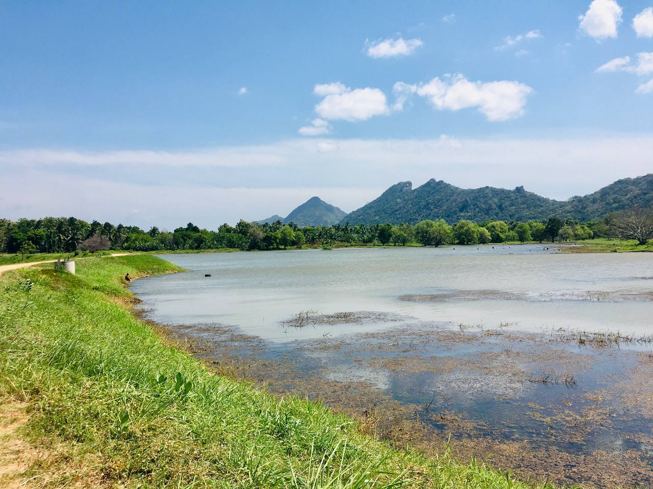
This is a very beautiful place surrounded by greenery, and with a nice view of the mountains. It serves a lot for the local community, as well. So, I just thought to have a look at the current status of the lake and what we have contributed to the area.
The Location
The reservoir is situated in Konketiya village, a bit far away from the main city. From Buttala bus stand, we have to go around 12km along the Buttala-Kataragama main road. And after that, take a left at the junction along the sandy road about 1km. There are two lakes nearby, and you can identify this one with the big name board.
The access road from the main road

The name board

As you can see, it's the typical village in Sri Lanka. The beauty of the area is just amazing, and I felt the nostalgic feeling on my way to the location.
The area belongs to the dry zone of the country, and the local community is mainly dependent on the paddy cultivation. Normally, there are two seasons for the year: Yala & Maha. During the Maha season (from October to January), people can rely on the rain during the cultivation, but during the Yala season (May to August), people need a source of water. That's where the lake and related irrigation systems serve the purpose. There are thousands of lakes around the island; some of which were constructed even a thousand years ago.

General Details
This lake was built around the 1970s, with the effort of villagers under the supervision of the government. Some of those contributors are still alive, and they were given a portion of the commanding area. I will share some of the details of the survey and general details that we took during the construction period.
- Type: Small-sized reservoir managed by the Agrarian Department
- Grama Niladhari Division: Konketiya
- River Basin Name: Manik River
- Capacity: 100 Acre ft.
- Net Catchment area: 70 Ha, Gross catchment area: 310 Ha
- Command Area: 40 acres, Number of farmer families - 25
- Name of Famer Organization: Thibirigas ara Wewa
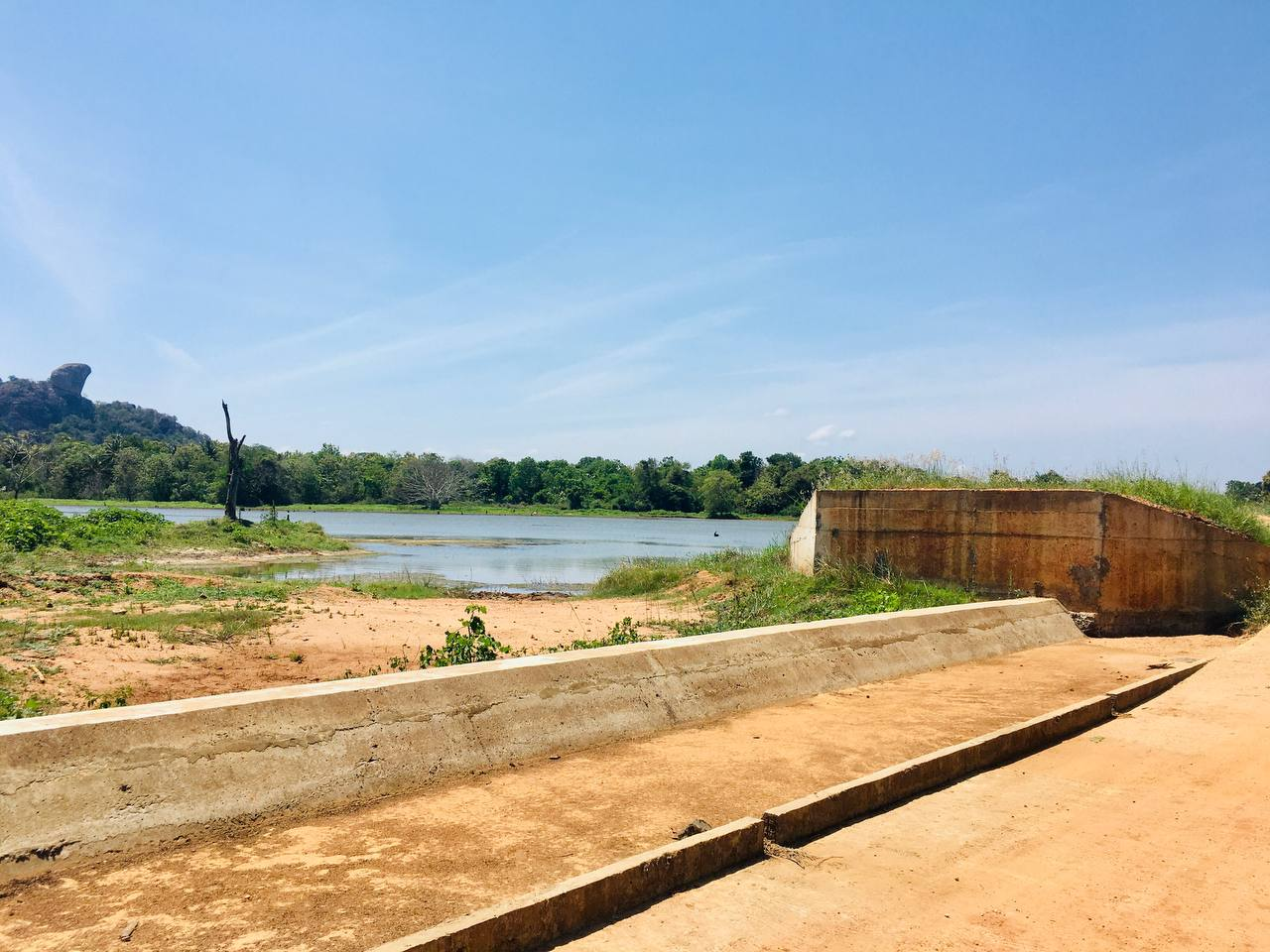
Tank bund

Left sluice

The bunt is the large embankment that helps to hold the water. As you can see in the left image, it's an earthen one. We improved the bund both in height and width to increase the capacity of the lake. The length of the bund is 500 meters, and the top width is 4 meters. Now it's in very good condition, without any leakages. Light vehicles are allowed to pass through it as well.
Sluice is a very important feature in a lake that is used to release water in a controlled manner; here into the paddy fields. There is a person allocated here to control and share water with everyone fairly. There are two sluices here with 225mm pipelines, which were renovated in 2023. There is a special key to open the gates whenevr necessary.
The spill
The spill way

- Spill allows the excess water to flow away automatically during the heavy rain. There is a maximum level of water that a reservoir can store to protect from possible damage to the bund and to avoid the flooding of nearby lands. This is a normal crest spill, where water can freely pass away when it reaches the spill level. It's 20m long, situated in the right bank.
Water then falls into a concrete base to avoid erosion, and then the starting part of the spill tail channel is packed with rubble masonry. From there, it's a natural earthen canal.
The water level is very low these days, but we could witness the spilling during the construction. We raised the spill by 1.5 feet to increase the capacity of the lake.
The canal

Farmer turnout

Canal carries water from the reservoir to the paddy fields. There are two canals attached to two sluices. Both are around 1km in length, where around half has been concreted as shown in the above images. The concrete canals, avoid the wastage of water. These are 0.3mx0.3m in size.
Farmer turnouts help to direct water from the canals according to the requirement.
The command area after harvesting

The command area during the Yala season in 2023

Command area is the land cultivated using the particular reservoir. Here, mainly it's for the paddy cultivation, and some short-term crops. As I said earlier, there are around 40 acres used the water by 25 families.
These days, the harvesting is finished, and the right image is an old one taken during the cultivation. Can you imagine the sceneary here, from one side of the bund it's filled with the greenery from paddy fields. And the other side is just amazing with the bluish water, and rising mountains from the horizon.
A few images during the construction


These are some photos taken during the renovation in 2023. There are hundreds of them with each step of the construction. I am very grateful to be a part of this type of important project for the community. And even happier to see the current good condition of it.
So, if you are nearby, pay a visit here to feel the peaceful atmosphere, and beautiful scenery.
| The Place | Thiththawellara Lake - Konketiya |
|---|---|
| Type of place | Lake |
| Name of the President & the contact | R.M Gunadasa, 0723420430 |
| Opening days and hours/entry fees | N/A |
| Location | on Google Maps |
| Website/ Social Media | N/A |
| Time of Visit | recent visit 15th of August, 2025 |
Until the next time! Enjoy!
Thank you.
Best Regards!
Upvoted! Thank you for supporting witness @jswit.
Hello dear @damithudaya
Thank you for using Steem Atlas and pinning your post.
Here is the detailed information.
Your post has been displayed on the Steem Atlas map.
https://steematlas.com/@damithudaya/thiththawellara-lake-konketiya
Thank you for setting the beneficiary from your post to @steem-atlas, it will help the project grow.
To learn more about Steem Atlas, follow the instructions below and follow the @steem-atlas account.
Best regards, Josh.
The more I read about your country, the more I feel bad for my country. Such a nice system to develop the lives of farmers! Here, we are killing ours. Not by hand, but system.