Travel day photos- June 3, 2019
I flew from Missoula, MT to Minneapolis, MI, and from there to New Orleans, LA today.
The first flight took off at 5:35 am. Which meant I had to be at the airport around 4 to 4:15 am. So I got about 3 hours of sleep the night before... but I knew I would sleep on the flight.
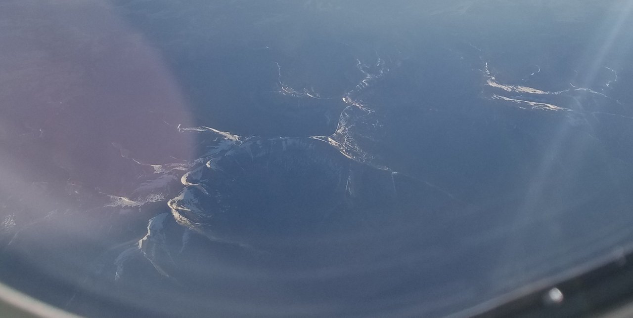
I was awakened by some commotion behind me, another passenger was having a medical emergency! The flight attendants were amazing and luckily there was a Dr on board and he was quickly helped. I was looking out the window and saw this cool Mountain, so I snapped a picture. Then I looked up the area on the flight map so I could research it tonight.
Sunrise over Lewistown, MT-

Knife Edge Ridge near Old Baldy Mountain-
Screen shot from google satellite view-

Once we landed in Minneapolis, emergency service staff helped the guy and his family off the plane and then the rest of us were released. My next flight was just a few gates away and I had time to grab a coffee and pastry for breakfast.
Usually I knit on my flights while listening to a audio book. I discovered that my earbuds had been left at home, so I ended up reading instead. Today's book was An Illusion of Thieves by Cate Glass.

I found it engrossing and well written. It turned out to be a neat bit of world building and I look forward to future books in the series.
The next portion of the trip took me over Jefferson City, Mo where several friends live and I have been worried about the flooding there. They also had a tornado hit town a few weeks ago. I snapped this shot of the Mississippi River just west of their town, so much flooding!

I got a few more images of the river flooding as we got further south, this is hard to see but there are many flooded fields along the river-

In Louisiana, they have opened the Bonnet Carre spillway to move water from the river to the lake. This area is usually a huge swamp full of alligators and birds. Right now it is a river in it's own right. This is it spilling water into Lake Pontchatrain -

And the diversion dam is open at the river levee- left side of the picture is where it was opened. It floods the whole swamp area to keep towns further downstream from flooding.

A view of the lakes- I am staying and working where the road between the lakes meets the main highway. Just outside this image to the left is LaPlace, La.

As I drove to my hotel, I pulled over to check out the flooded Bonnet Carre spillway.

I was going to get out of my vehicle to get a better photo, then I watched several alligators swimming around and thought better of taking a walk. This was the best photo that turned out. In all my others, you can't see them due to the tree reflections.

I was so tired when I got to my hotel, I ended up taking a 5 hour nap! Then I cleaned up my photos and wrote up this post. Tomorrow I get to do some training and then look forward to exploring a little more!
No post for needleworkmonday, been too busy with work and didn't have earbuds for the trip. Will have to pick some up this week so I can knit on the flight home on Friday.
Cool to see alligators, from a distance.